 Djinious
Any standard LiDAR
Point clouds ingested, CRS-aware, and tiled to COPC with a browser preview. Survey scanners, airborne LiDAR and phone captures enter the same pipeline.
LAS · LAZ · E57 · PLYThe platform
Each application does one part of the work — and hands its evidence to the next. Use them together, or one at a time.
Platform overviewSee how the loop runs DjiniousEngineeringOrchestration
 DjiniousLabModelling & simulation
 DjiniousWorkshopSystem integration
 DjiniousSafeCertifiable code
 DjiniousWorld3D replicas
 DjiniousMapAgent GIS
 DjiniousCCOperations & SCADA
 DjiniousDataKnowledge base
 DjiniousWorkflowAgent automation
 DjiniousWorld3D replicas
DjiniousWorld captures the physical world, maintains it as a living digital replica, and turns that replica into engineering decisions and simulation environments. Every replica is versioned, multi-representation, multi-epoch and auditable — and every measurement traces to a capture, a run and an accuracy grade it has actually earned.
 DjiniousWorld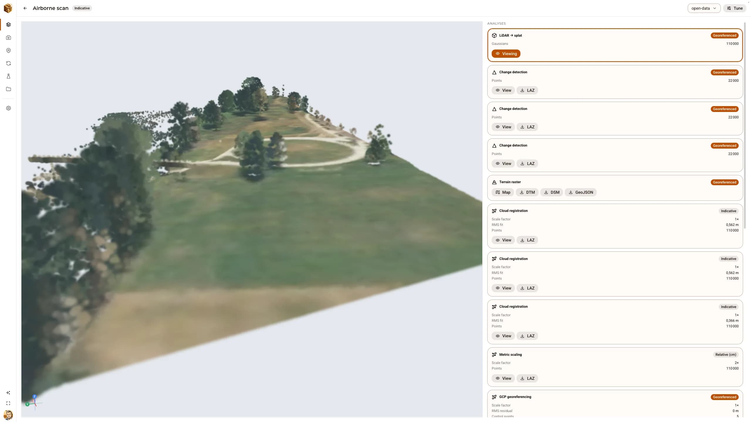
What it is
Upload a point cloud, a set of photographs or a video; one API call runs the reconstruction and registers every result as a representation of the replica. Capture hardware is a spectrum, not a gate: what differs between a phone and a survey scanner is a declared, propagated accuracy grade — never a hidden quality difference.
Point clouds ingested, CRS-aware, and tiled to COPC with a browser preview. Survey scanners, airborne LiDAR and phone captures enter the same pipeline.
LAS · LAZ · E57 · PLYStructure from motion from an image archive or a video, with sequential matching for forward-motion footage, then dense multi-view stereo on a GPU host.
COLMAPPhotoreal splats trained from posed images on the GPU, or built directly from a coloured LiDAR cloud — and LiDAR-anchored training that inherits metric scale.
gsplat · 3DGSOrthomosaics, textured meshes, DSM and DTM rasters with contour lines, and annotation export to DXF, GeoJSON, KML and CSV.
GeoTIFF · OBJ · GLB · LAZDistances, areas, volumes with cut and fill, and multi-epoch change detection — every figure carrying the uncertainty its grade allows.
M3C2A replica mesh exported as an OpenUSD physics scene with a static collider, then settle-tested with a rigid probe so it is proven simulatable, not just parseable.
OpenUSD · UsdPhysicsInside the product
Every capture below is the running product.
01 · Honest grading
Grades are totally ordered — indicative, relative_cm, georeferenced, survey — and every derived representation, measurement and finding inherits the minimum grade across its full lineage. Pure photogrammetry has no metric scale, so it is declared indicative, never higher.
02 · Photogrammetry
The five-stage survey application runs structure from motion, dense multi-view stereo, meshing, mesh texturing and the orthomosaic in one call, dispatched to a GPU worker. Ground control is marked in the viewer with live residuals, and the fit moves the camera poses too — so the orthomosaic and textured mesh are rebuilt on the new datum.
DjiniousWorld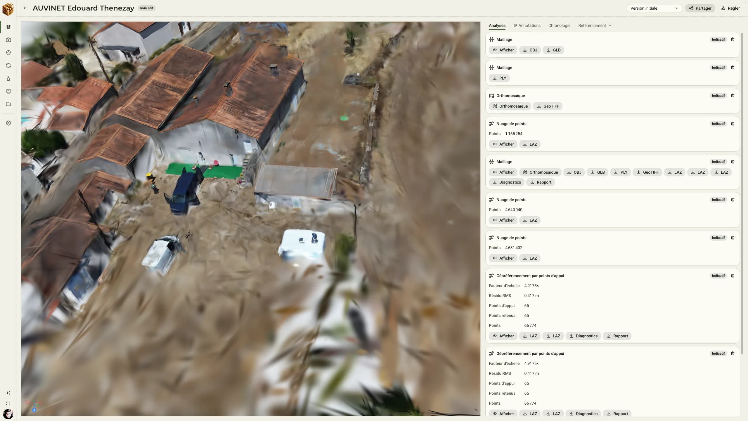
03 · Gaussian splatting
The flagship reconstruct application runs structure from motion on the CPU and trains a Gaussian splat on a DGX Spark GPU, the splat stage consuming the SfM bundle automatically. The trainer holds out every Nth image and scores the unseen views, so fidelity is measured rather than asserted.
04 · Time
A replica holds epochs — its state from one campaign after another. M3C2 change detection compares a baseline and a current cloud and colours every core point by its signed distance: added or raised, removed or receded, or below the detectable threshold. A change smaller than the minimum detectable is reported as no change, never as zero.
05 · Simulation
The replica is an OpenUSD stage, so a mesh becomes a physics scene without a lossy export step: gravity, a static triangle-mesh collider and a ground plane, with convex decomposition available for movable objects. A settle test drops a rigid probe with MuJoCo onto the collider and judges the trajectory — supported, settled, no tunnelling.
AI & agents
Everything the web interface does, an agent can do through the API: create a site, upload a capture, launch a run, poll it and fetch its results. The entire video-to-splat pipeline has been driven end to end through the API with an API key alone.
Thirteen declared operations over sites, replicas, epochs, representations, captures, runs and artifacts, with idempotency keys, jobs and provenance.
API key-secured JSON-RPC that lets AI agents operate the app and understand its architecture.
A tool-calling assistant with read access to the data, approval-gated write access, and the ability to ask for a choice mid-task.
Trust
A feature is recorded as verified only when a test asserts the behaviour and that test was run — through a browser where it is something a person uses. What cannot run on the build host is recorded as written and unrun, not glossed over.
Real airborne LiDAR, real multi-view photographs and a real co-registered laser scan, all driven through the API.
Each representation traces to the run that produced it, and an annotation is graded from the representation it was drawn on — naming a representation is never naming a grade.
COLMAP, PDAL and gsplat are permissive; copyleft tools run only as subprocesses, and non-commercial models are excluded.
Organisations with roles, read-only share links, signed webhooks, and usage metered against quotas.
In the digital thread
DjiniousWorld does its part of the engineering loop and passes its evidence along — and it works just as well on its own.
Receives
DjiniousEngineeringThe site the project needs as context, and the captures of it to reconstruct.DjiniousWorld3D replicasDelivers
DjiniousEngineeringA graded, versioned replica of the real environment — the physical surroundings of the twin.DjiniousWorkshopOpenUSD physics scenes with settle-tested colliders, ready for integration and simulation.DjiniousMapGeoreferenced orthomosaics, DSM and DTM rasters and contour lines of the surveyed site.On its own, DjiniousWorld is a reconstruction and survey platform: bring LiDAR, photographs or video, and get point clouds, splats, meshes, orthomosaics and measurements with an accuracy grade you can trust.
Use cases
1 worked case.
Book a demo
See your own captures become a replica — and see exactly how far each number can be trusted.
Along the thread
 DjiniousEngineeringOrchestration
The AI systems engineer: it takes the assignment and carries the whole project through a traceable System Ledger.
 DjiniousWorkshopSystem integration
Components wired into a complete system and closed through GPU physics in NVIDIA Isaac Sim.
 DjiniousMapAgent GIS
A governed geospatial control plane: data is harvested, measured and only then drawn.
 DjiniousWorkflowAgent automation
Graph automation any stage can call on: build a process, run it, watch it and audit it.