 Djinious
Ingest
COPC and a browser preview of all 110,000 points.
pointcloud.ingestThe platform
Each application does one part of the work — and hands its evidence to the next. Use them together, or one at a time.
Platform overviewSee how the loop runs DjiniousEngineeringOrchestration
 DjiniousLabModelling & simulation
 DjiniousWorkshopSystem integration
 DjiniousSafeCertifiable code
 DjiniousWorld3D replicas
 DjiniousMapAgent GIS
 DjiniousCCOperations & SCADA
 DjiniousDataKnowledge base
 DjiniousWorkflowAgent automation
DjiniousWorld was validated end to end on public datasets — the Autzen airborne LiDAR cloud, the Middlebury temple photographs and the ETH3D “pipes” scene — every step driven through the API, every result carrying the accuracy grade it earned.
 DjiniousWorld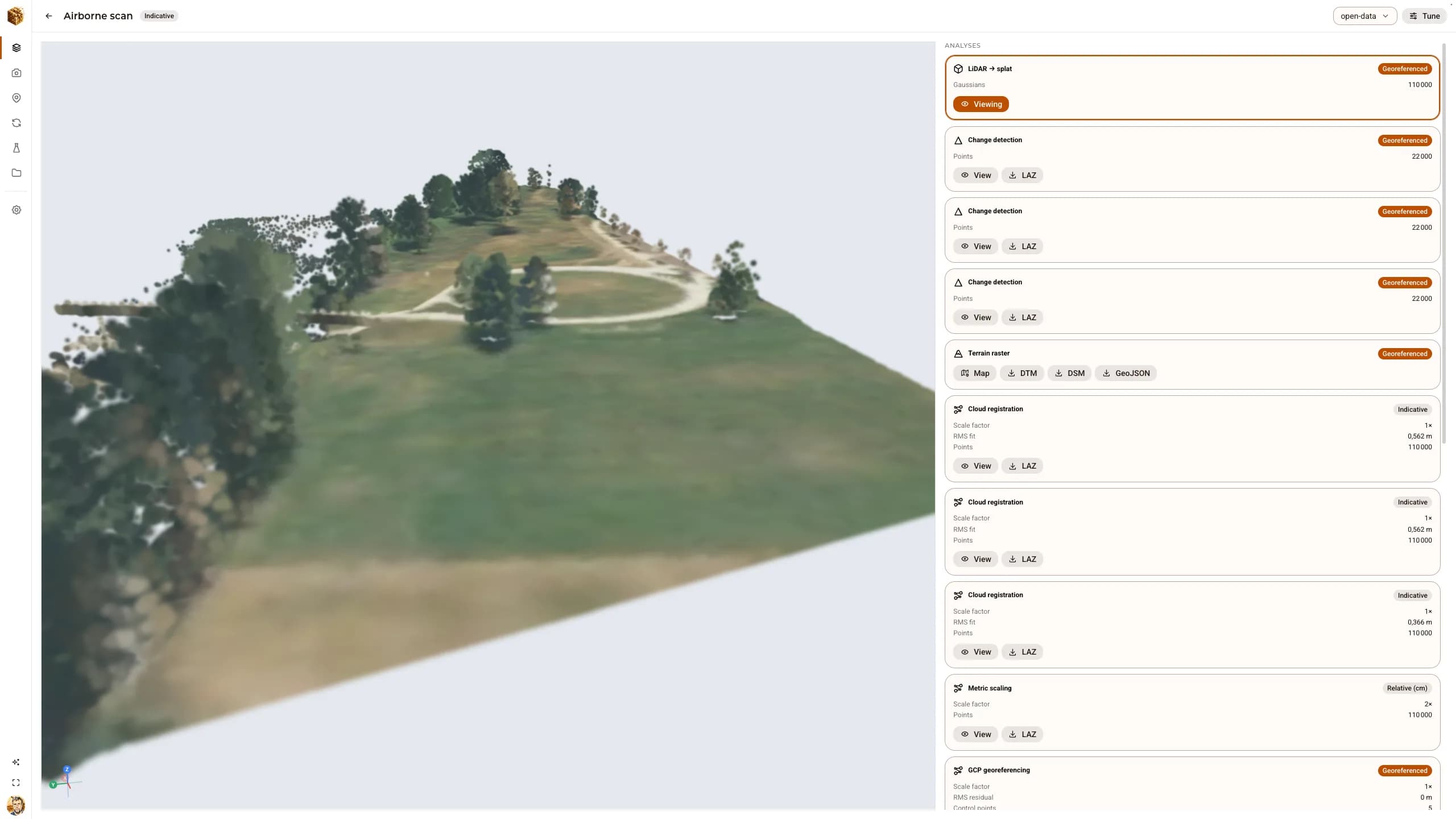
A reconstruction platform is easy to demonstrate on its own fixtures. DjiniousWorld was instead run on the canonical public test sets, so every figure below can be checked against data anyone can download.
110,000 points in projected coordinates, ingested and then worked through the analysis catalogue.
COPC and a browser preview of all 110,000 points.
pointcloud.ingestA Poisson surface of 129,642 vertices and 259,374 faces.
analysis.meshGround 87,392 · structure 1,403 · vegetation 21,205 points.
analysis.segmentDSM and DTM GeoTIFFs at 1 m and 34,798 contour segments at 5 m.
analysis.rasterAbout 2.0 million m³ above a 411.09 m base, ±2,973 m³ — the band that the grade allows.
analysis.measureThe mesh as an OpenUSD physics scene, settle-tested with MuJoCo: valid collider, georeferenced origin preserved.
export.usd_physics_validatedFour ground control points recovered the transform exactly and earned georeferenced. With a fifth, blundered by 18.8 m, RANSAC rejected it and the grade held.
A 1.5° rotation recovered to about 0.02° — and honestly capped at indicative by the reference’s 1.34 m point spacing.
Two known lengths of 100 m and 50 m agreeing on 2.0× — relative_cm, metric but local.
The 47 Middlebury temple photographs into a 7,444-point sparse cloud and an SfM bundle.
On a DGX Spark GPU, densified from about 7,400 initial points to over 23,000 gaussians.
With 41 images for training and 6 held out: PSNR 34.05 dB and SSIM 0.9958 on views the trainer never saw.
14 DSLR images and a 24.3-million-point registered laser scan of the same scene.
Keep exploring
 DjiniousMap
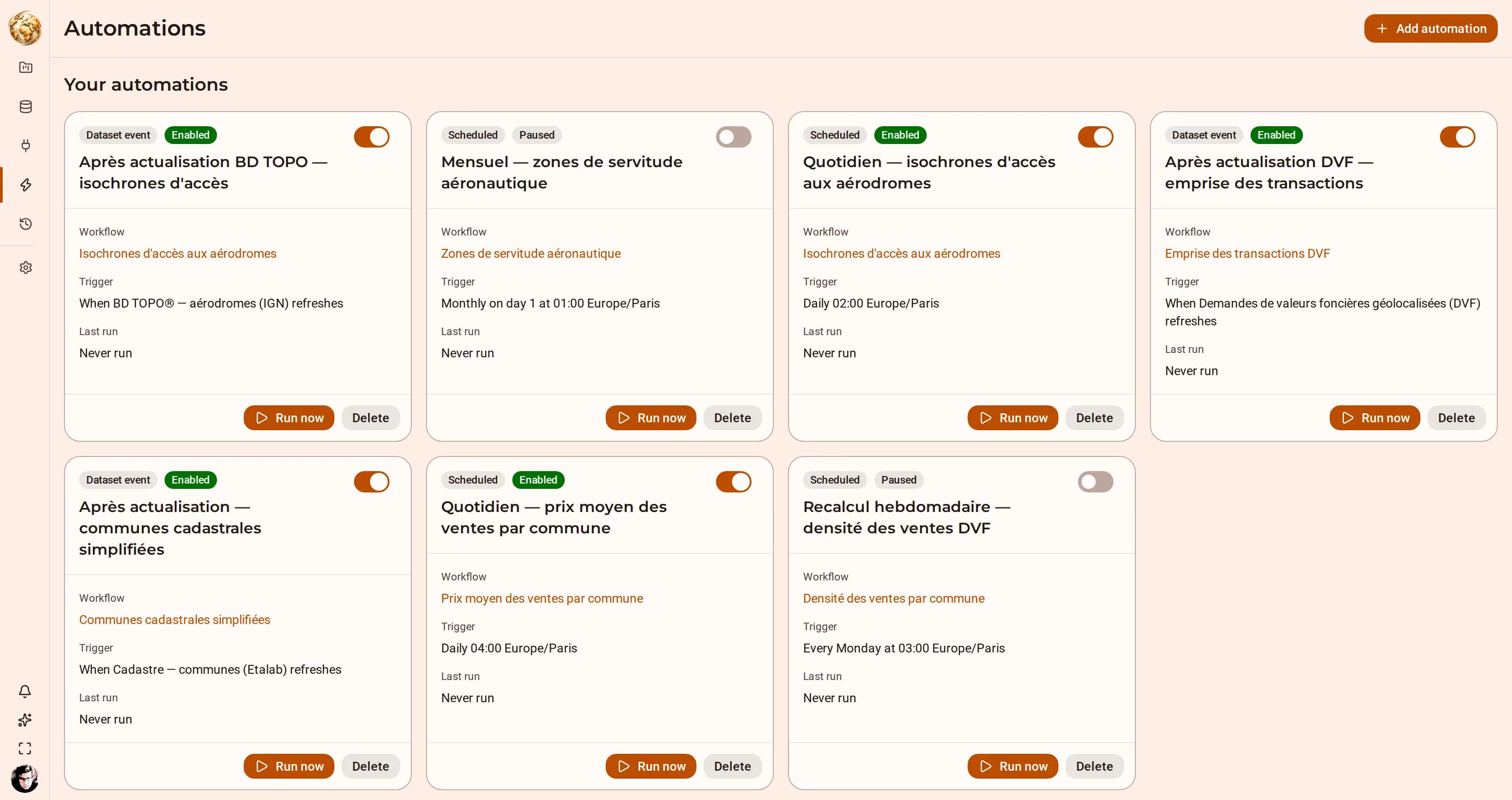 Territory · isochrones and routingAccess and service coverageAnswer “what is within twenty minutes of here” for every site in a layer, and keep the answer current as the source moves.DjiniousMap
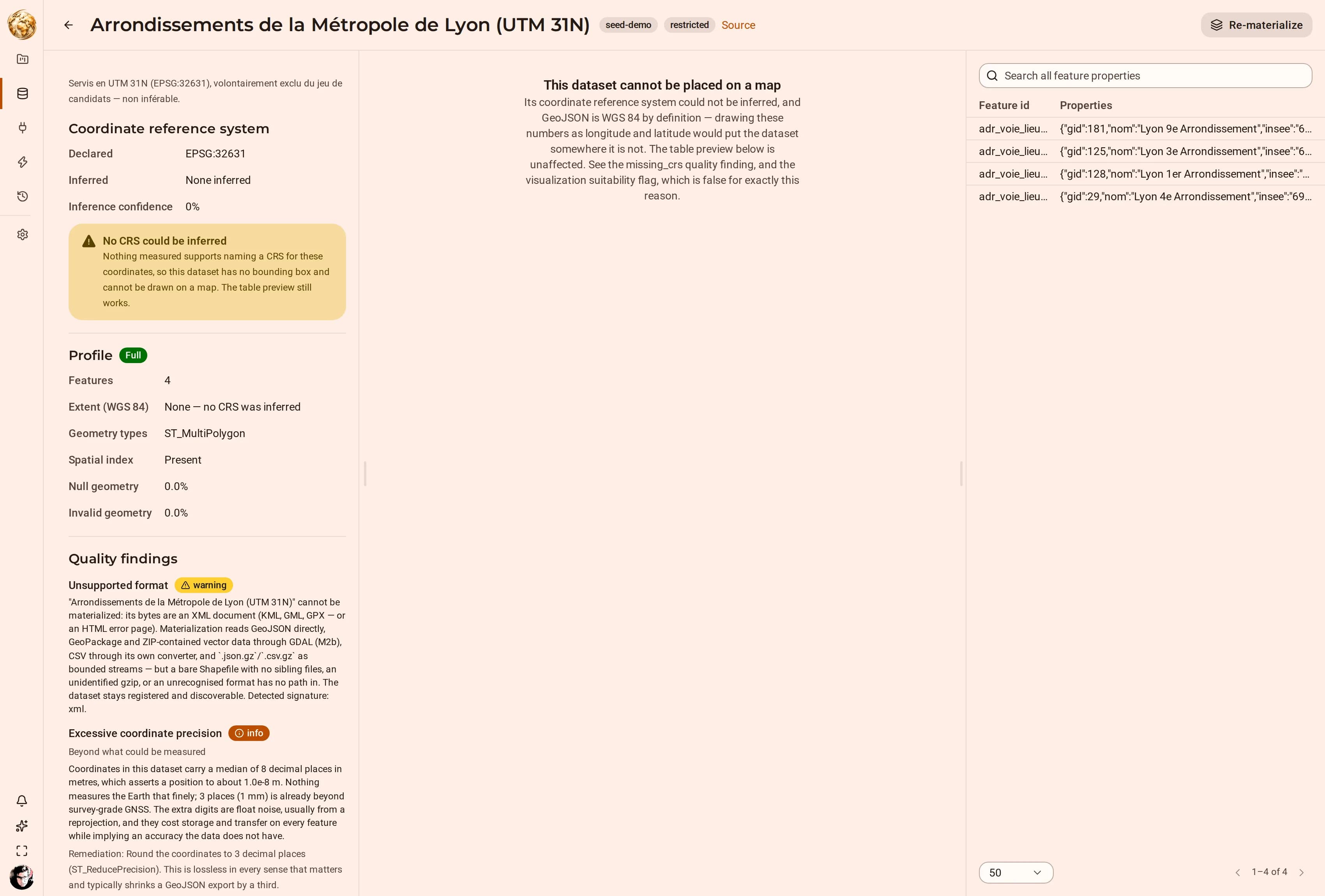 Municipal open data · trees, cycle networks, sports facilitiesMunicipal asset inventoriesBring the small, messy, locally-published datasets together — and find out which of them can be trusted before you draw them.DjiniousMap